Sunday, July 22, 2007

Prince Rupert, BC

Check out the pictures from Nick!

Original Quick Update:
---------------------------
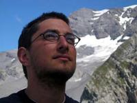
(no time for spell checking, sorry). Nick Phelps and I have arrived in Prince Rupert
(North America's wettest city), BC after a wonderful cruise-like ferry ride from Port Hardy. The 15-hour ferry ride goes along the most uninhabited BC coast and the inside passage - a deep water navigatable channel with 1000+ meter mountains rising out of the sea on both side. Incredible. Prior to the ferry, Stacey and Nick Cowan joined me for cycling from Vancouver, up the Sunshine Coast, then to North Vancouver Island to Port Hardy. The Sunshine Coast was beautiful, nice roads, and big hills. It was a good warm up for the interior trek from Campbell River to Port Hardy. While the hills on this part of te trip were much larger, there were very gentle grades, so the hills lasted kilometers and took an hour to climb which was very demoralizing at first. But after we discovered that we had some huge downhills to bomb down wafter our endless hill climbs, it seemed worth it. We wilderness camped after Campbell Rive - the first night on a logging road and the second night on the banks of the Eve River. It was really great to have friends along for the ride, and speaking for all of us, it was a blast! The next stretch will be more trying physically and mentally as we head into true wilderness and grizzly country, but evertime we talk with the local, we get all kinds of suggestions of amazing lakes and glaciers to check out on the way up (mostly visible from the road).

Today is another rest day - figuring out cargo configurations with two riders, picking up the new Harry Potter, and waiting until Monday morning to pick up a package from the post office. Then 12 days of none-stop cycling fun to Whitehorse!

Until the Yukon....

Journal Posts and Pictures:
----------------------------------

Day 1:

And they are off!


Chillin' in the shade


The Olympics are coming!


Nick's sad because we missed the ferry, Stacey is happy we didn't leave her behind:


Sunset on the ferry:


Day 2:
In search of coffee:


Day 3:
Condensed Milk - 1300 calories of yumminess!


Day 4:
Cross the pass:

Sunday, July 15, 2007

MAP 2

Here's a map of my route from North Vancouver to Whitehorse

Thursday, July 12, 2007

Vancouver and Getting Stoked!:

I'm in Vancouver after 3 days of cycling from Cortes Island. Nothing to report really except it was really hot. Yesterday I got on the road before 7am for that I would have my 90+km day done before 1pm. When I finished my ride, I set up my hammock on the shade and slept/read until dinner.

I'm staying in Vancouver for the weekend. Then starts my 3-week adventure to the Yukon. The longest stretch will be on the Stewart-Cassiar Highway. Wikipedia gives the following history:
-----

History

The Highway 37 of today is the result of highway extension projects begun during the 1960s and climaxing in 1972.

Originally, a roadway extended south from the Alaska Highway to serve the Cassiar mining district, eventually reaching Dease Lake and joining a road to Telegraph Creek (sometimes referred to as Highway 51, but not signed as such). To the south, logging roads extended north almost as far as Meziadin Junction.

By 1968, the route of what is now 37A extended past Meziadin Junction north. By the middle of 1972, only a few miles remained to be built between Meziadin Junction and Iskut. Four bicyclists, whose journey from Alaska to Montana was chronicled in a May 1973 National Geographic article, braved the muddy gap.

Once this route was completed, travelers only had to contend with limited hours for using the logging roads south of Meziadin Junction, roads which were upgraded during the 1970s. The completion of a new bridge over the Skeena River gave Highway 37 a more direct connection to Highway 16.
-----

Today all but 40 km are paved. Its not the adventure is was 40 years ago, but it should still be a fantastic trip.

Monday, July 9, 2007

Update: Pictures

Here are some more pictures from the road.

Saltspring Island Ferry:


Cycling on Trans-Canadian Highway:


Admiring Qualicum Beach:


View from the ferry to Quadra Island:


Raking hay on the Linnaea Farm, Cortes Island, BC:

Sunday, July 8, 2007

MAPS!!!!

Here's a map of my route thus far.

Day 13: Linnaea Farm, Cortes Island, BC

Original Post:

A quick update while I have Internet access. I'm visiting my friends Nina, Steve, and Heather (McGillicans) at their organic farm school/ school farm. Life is good here. Lots of work to be done....yeah, its a farm, but in good community spirit. Basically everything during the day is food related - growing, processing, or eating. The only exception being swimming in beautiful Gunflint Lake which unlike the ocean around here, is warm enough to swim in.

I cycled up here (passing 50N on the way) from Victoria be way of Saltspring Island, Nanaimo, and Campbell River. It took me 2.5 days to cover 280km...in the blistering heat (for BC standards). I covered 80km on the first day, limited by ferry schedules and warming my legs back up after several days off in Victoria. After eating dinner at a true English Pub (I had a Cheddar Ploughman and a chocolate porter), I camped at a run down campground nearby because my leg hurt and it was close. Day 2 was my challenging day in that I wanted to see how far I could go. In the end I only made it 140km -head winds in Nanaimo slowed the pace in the morning and I had to sit out the afternoon heat as I started to experience some heat exhaustion. I camped on the ocean (with views of snow capped mountains) at Coleman-Kitty Beach Prov. Park.

Cycling up to Cortes was no problem. Beautiful roads along the coast, winds not horrible. When I got to Cortes though, I was in for a surprise. First, from the island, you can see snow capped mountains on the mainland and Vancouver Island....amazing. Second, there are a few hills on the island....and they are somewhat steep. So what I thought would take 30 minutes to ride at a civilized pace ended up being a 1 hour grueling up and down toil that required many foul words to be said. I also had to push my bike up a hill...something I haven't had to do in years. The worst part was that I couldn't even ride out the hills because the road was incredibly rough and I would get speed in excess of 50 km/h easily due to the steepness of the hills. It was a humbling experience reminding me that the ride to the Yukon will be a challenge and that I need to ship some stuff to Whitehorse to lighten my load.

Back to life on the farm, yesterday I harvested sour cherries (and ate sour cherry jam, sour cherry ice cream, and sour cherry platz) hilled potatoes (putting dirt on top of potato plants to increase tuber production) at the potato co-op (a 25 household potato patch), had a wonderful swim, and cooked a feast of a lasagna for dinner. Today is haying day, so I'll following a tractor with a rake to line the hay up for the bailer, then hauling the bails to the trailer. Its a community work party so every works, then everyone parties. Its a good life.

Tomorrow I'm back on the road again. I was hoping to hike with Erica, but schedules didn't work out. I think I'll be cycling to Tofino, BC before heading to Vancouver for the Folk Music Festival next weekend.

Sunday, July 1, 2007

Pictures!

Here's a best of sampling of pictures:

Portland, OR from the Aerial Tram:


Tillamook Cheese Factory:


Oregon Coastline (Oswald West State Park):


Aberdeen, WA Lumber Yard:


Downtown Seattle, WA from Fremont (over Union Lake):


Yours Truly on the Beach (Cape Disappointment, WA):


Action Self - Portrait:

Victoria, BC: Happy Canada Day!

When we last left of intrepid adventurer (lazy vacationer), I was heading for Vancouver Island via the San Juan Islands from Seattle. My Cousin Terri kindly dropped me off on the Mulkiteo (sp?) Ferry, saving me the pain of cycling through the northern Seattle suburbs. While cycling around Seattle is fantastic, getting out of town is a bit more difficult...unlike Portland which has bike lanes all the way to the country side. My plan was to camp on Lopez Island but by 4:30 is started to poor and I was still a good three hours from my destination. I ended up camping at Deception Pass (named by Captain Vancouver because he thought he found a bay but instead found an island). Yesterday I caught the ferry from Anacortes to Sidney, BC, a three-hour ferry plus three-hours of waiting for the ferry. I'll be hanging out in Victoria for the next couple days, visiting McGillican friends then cycling for 3 or 4 days heading to Cortes Island to visit Nina, Steve, and Heather at their farming school. I may have some free time this afternoon to post pictures...but I may take a nap instead...it is my vacation after all.